First can I say thank you to you and all of your staff for what was an amazing trek to EBC and KP 😊 I loved every minute, felt completely…
Read more
Overview
Our unique itinerary to climb Japan’s Highest Peak.
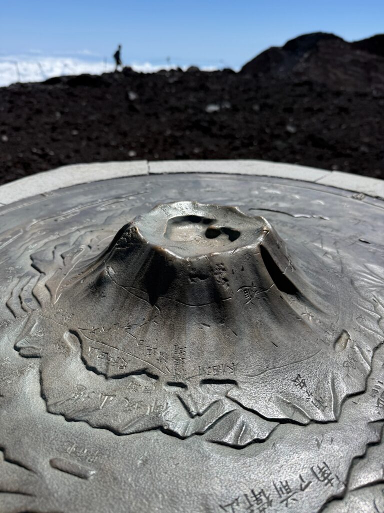
Mount Fuji is Japan’s highest Peak at 12,389 feet (3,776m) high. I had always wanted to climb Mount Fuji but with so many other mountains to climb it was put on the back burner. As Fuji is a 2-day climb, I wanted to add in some other trekking options in Japan so we came up with the best trekking options Japan has to offer linked in with a Mount Fuji Climb.
We starting elevation on Mount Fuji is at 7,874 feet and we like to hike up to 10,827 feet to stay the night and ascend early in the morning to the summit at 12,389 feet. We then return to the refuge, back up and go all the way back down to the starting point.
Even though accommodation on Mount Fuji is extremely basic, I think if It worth spending the night on the mountain to aid acclimatization before going to the summit and taking on the steep descent back down again.
Climbing Mount Fuji is a once-in-a-lifetime adventure, but we’ve taken it one step further by creating a unique 8-day itinerary that goes far beyond the standard summit hike. Our carefully crafted journey combines Japan’s two highest volcanoes—majestic Mount Fuji and sacred Mount Ontake—into one extraordinary experience.
Along the way, you’ll explore hidden trails, immerse yourself in Japanese culture, and even trek sections of the famous Nakasendo trail, once traveled by samurai and merchants centuries ago. This isn’t just a climb—it’s a deep dive into the landscapes, history, and traditions that make Japan so special.
With our expert team, you won’t just stand on top of Japan’s most iconic peaks—you’ll discover remote paths most travelers never see, enjoy authentic cultural encounters, and move at a steady, safe pace designed for real adventure. By blending two legendary volcanoes with off-the-beaten-path trails, we’ve created a one-of-a-kind expedition that balances challenge, beauty, and culture.
If you want more than just a quick climb of Fuji, this itinerary delivers a rich, unforgettable journey through Japan’s heart and high mountains.
Upcoming Trips
2026
Jan
Feb
Mar
Apr
May
Jun
Jul
Aug
Sep
Oct
Nov
Dec
No trips found for Jan 2026.
No trips found for Feb 2026.
No trips found for Mar 2026.
No trips found for Apr 2026.
No trips found for May 2026.
No trips found for Jun 2026.
No trips found for Jul 2026.
No trips found for Sep 2026.
No trips found for Nov 2026.
No trips found for Dec 2026.
Itinerary
1
DayArrive in Tokyo
Arrive into Tokyo and make you way to our hotel in Tokyo.
2
DayTrain to Narai
You will be up early this morning to start your journey into Rural Japan. Your guide will meet you at the hotel and escort the team to the train station and you will head towards Matsumoto and onto Narai. Once in Narai your duffel bag will be shipped to you hotel. You will explore the town of Narai and hike over the Torii Pass to Yabuhara. From there we will transfer you to our hotel near Kiso Fukushima.
3
DayHiking Near Ontake Mountain
Using a chartered vehicle, move to Otaki Village and to the Ontake Kodo and hike (6km). Waterfall purification may or may not be possible. Stay in a ryokan in Otaki Village.
4
DayClimb Ontake Mountain
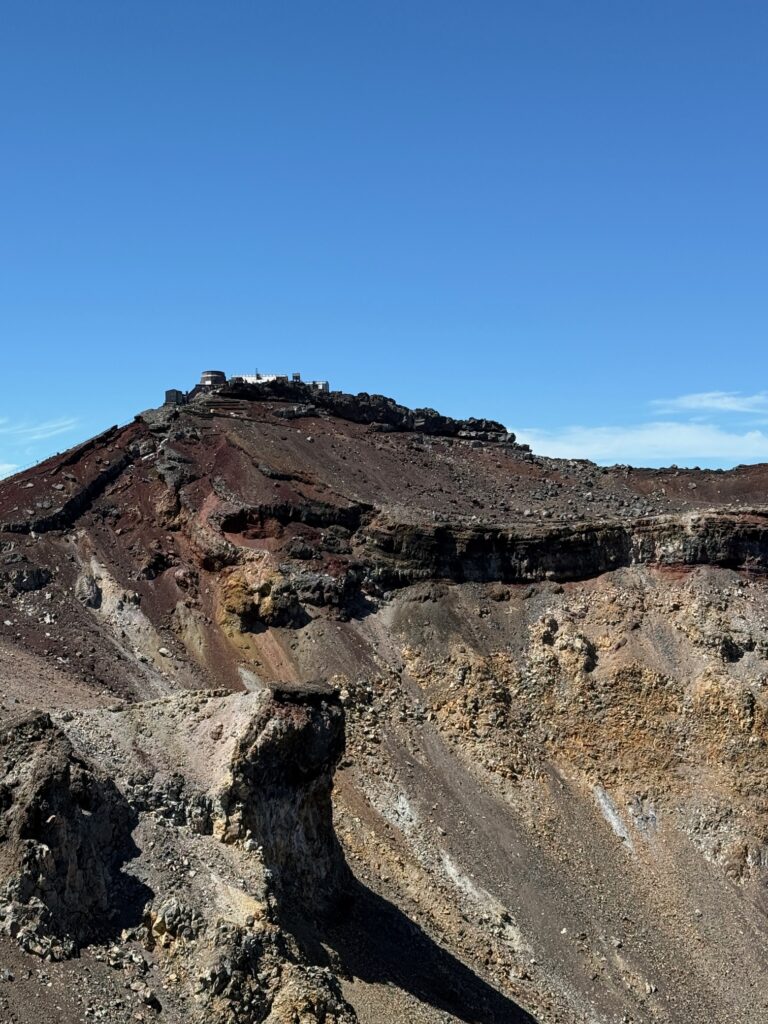
Climb Mt Ontake (8km). Ontake is the second highest Volcano in Japan. Ontake is a 10,062 feet (3,067m) It will be best to get an early start today to avoid the frequent lightning storms in the afternoons. After the hike, the team will move to Tsumago and stay there for the night.
5
DayHike Tsumago to Magome
Hike from Tsumago to Magome (with a support car to keep the conditions safer considering the heat). After the hike you will either stay in Magome or Nakatsugawa Depending on availability.
6
DayTransfer to Konohananoyu onsen
Today the guide will transfer you by train to the Mount Fuji area. You can rest up, enjoy the Onsen and prepare for the ascent of Mount Fuji.
7
DayTrek to 10,827 feet
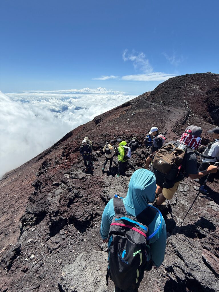
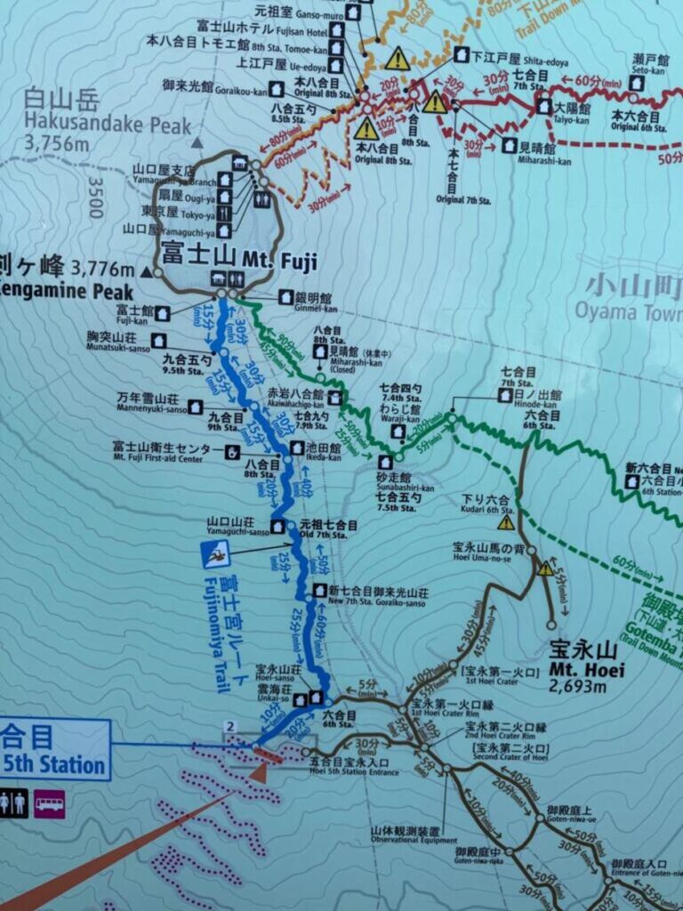
Your Fuji Guide will meet you at the hotel for a briefing. Climb Japan’s most iconic peak with our exclusive 2-day private Mount Fuji tour via the Fujinomiya Route.
8
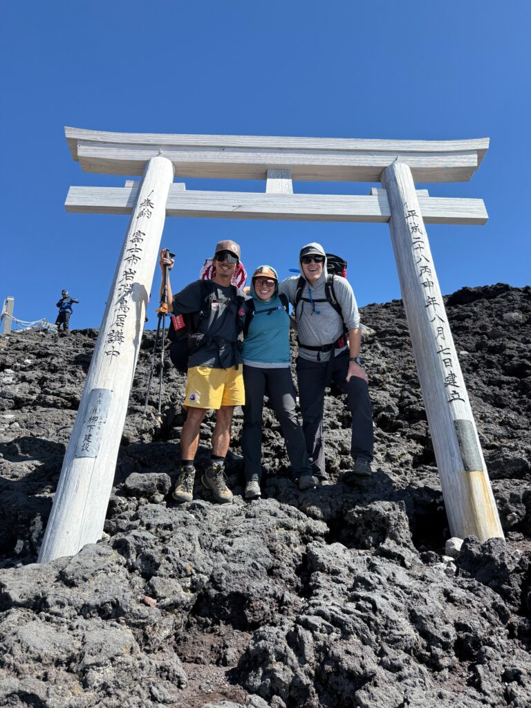
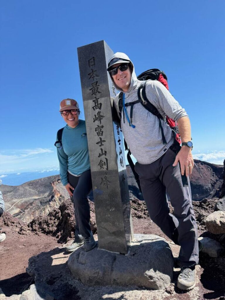
DaySummit Mount Fuji 3,776m/ 12,389 feet
You will be up early for the 2 hour ascent to the summit. Hike around the crater and back to the hut, pack up and return back down the mountain where you will be transferred back to the hotel.
Advice
Top Tips for Trekking to K2 Base Camp
The K2 Base Camp trek is a wilderness trekking experience and you need to be very comfortable with remote trekking, wilderness camping, long days hiking on a multi-day basis. We only run quality run treks to K2 Base Camp.
1). Have the Right Physical Training
You need to be physically fit and strong for multi-day hiking in a low oxygen environment. The K2 Base Camp Trek should not be your first trekking experience. We only recommend that hikers and trekkers attempt this trek to K2.
2). You Need to Comfortable in the Wilderness
You need excellent Mental strength. Being adaptable, flexible, resilient and comfortable at altitude. You do need to be comfortable in an outdoor environment. Make sure you have being training and preparing correctly. There may be a scenario that requires you to cover more distances and do more while in this environment. Simply put, do not do the bare minimum as you prepare for a trip like this.
3). Make Sure you Have the Right Gear
Adventure know how, making sure you have the right clothing, gear and equipment for all eventualities. You will experience a wide range to weather conditions on a trek to K2 so you need to follow our itemized kit list. We send out our Kit List on signing up to one of our treks.
4). Be Read for Camping
You need to be ready to over come challenges while camping, trekking and moving in a wilderness environment. You will experience good and bad days but important in a team and group environment to work as a team and stay positive during the trip.
5). Plan Well in Advance
It is really important to be planning your trip well in advance. All planning should be done 6+ months prior to departure to Pakistan. We have people planning a year or longer for a trek like this. We can not take any last minute bookings.
6). Have all the Correct Documents
Check all your documents. Your passport must be valid and correct, your visa needs to be in place and you need make sure insurance cover, evacuation cover and flights are all correct well before leaving for Pakistan.
7). Understand all aspects of the Trip
All information regarding the trip should be understood. Read all our information very carefully and prepare accordingly for what each day will bring.
8). Do you Have Your Visa
All ground arrangements, full trip, visa, hotels should be sorted well in advance. If you are booking additional nights hotel this will need to be booked and paid for in advance of your K2 Trek.
9). Make Sure you Trek With Professionals
Of course we will say this, but you should only go with a professional organisation. Having back up logistics, years of managing trips, local government connections and back up support are needed to make sure your trek and trip is managed correctly.
10). This Trek is for Trekkers not Tourists
Make sure you have the specific training needed for this specific trek. This trip is for hikers and trekkers. Having months and years of long distance hiking, training and preparation is important for a trip like K2 Base Camp. LEARN MORE.
11). The Daily Distances on the Trail
Understand the daily trekking distances and elevation gains and losses each day. You need to know so you can make sure you are training in the correct way. We can help you understand the trail, trek and how you should be preparing for your trip.
12). Have Helicopter Evacuation Cover
Make sure you have adequate insurance cover and have Helicopter evacuation cover. This is really important for this trip as you will be long distances away from real medical support. You also need to think about insurance cover, in case on any medical issues. A lot of people consider having trip cancellation cover for Pakistan. The last thing to consider is trip interference cover.
13). Wilderness Medicine
Consider a wilderness medical course and learn more about wilderness medicine. Bring the right medical kit so you can treat minor issue. You also need to bring re-hydration sachets to keep hydrated. Take multivitamins to keep you healthy throughout this long wilderness trip.
14). Manage Your Hygiene
We will prepare clean and quality food throughout the trip. So, you need to manage your personal hygiene at all times. You should be taking multi-vitamins prior and while on the trek to make sure you have a strong immune system throughout this trip.
15). Have Efficient Camp Craft
Make sure your camp craft is efficient and practiced so there are no delays in leaving camp each day. You also want to be comfortable sleeping in a tent. Get out and test your air mattress, sleeping bag, clothing and gear so you know they work.
Get in Touch
We hope you found this information of real value and hope you will consider joining one of our quality run K2 Base Camp Treks in the near future. CONTACT US for more information on both our itineraries and how we can help you come fully prepared for your adventure in Pakistan.
Daily Distances and Elevation Gains on the K2 Trek
When you are planning your training and preparation for your K2 Base Camp Trek you need to consider three things.
1). How much distance you will be hiking each day. You will need to be training for these types of distances on the trail to K2.
2). Consider the elevation gains will you be hiking each day. If you are hiking up and down hills and trails you need to be factoring these into your training.
3). Factor in the lack of oxygen. Training with a weighted backpack will help give you the physical condition needed for the trek.
Where you Start Your Training
When you combine these three factors you can build a training plan for your trek to K2. Below are the daily distances you will be hiking along with the distances. We recommend only hikers and trekkers join this trip. This is not a tourist trek. We also recommend that you are training 4/5 times a week building the time and hours you are training over months of training. We also recommend you build up to carrying double the weight you carry on the trail so building from 6kg to 12kg in your training.
After arriving in Islamabad you have to fly to drive to Skardu and onto Askole. After arriving and working your day to Askole on our itinerary you will start trekking on day 5 of our itinerary.
Day 5). Trek to Jhola
Trek to Jhola 3,200m/ 10,500 feet. We set off early to avoid the heat of the day, but the route is gentle and enjoyable. We cross the Biafo Glacier on the way and get our first sight of the Paiyu pinnacles. You will be trekking for 7/8 hours today. The Distance is 21km. Elevation Gain/Loss: 400m/ 500m Min/Max Elevation: 3,045m/ 3,159m
Day 6). Trek to Paiju
Trek to Paiju 3,450m/ 11,319feet. If the river is sufficiently low we will edge our way round the base of the huge rock walls that guard the valley towards the Baltoro glacier. We may have to make the higher traverse before we regain the old riverbed that leads to Paiju. Paiju will be our campsite for the next two nights. Despite the stories in old guidebooks and journals, much has been done in recent years to remove rubbish and human waste. The region is incredibly clean with well managed camps. In fact, they are some of the best we have seen. Daily Distance: 20.5 km Time trekking: 7-8 hours. Elevation Gain/Loss: 575m/ 334m. Min/Max Elevation: 3,115m/ 3,405m
Day 7). Trek to Khoburste
Trek to Khoburste 3,930m/ 12,894 feet. A tough day of walking as we tackle the rocky moraines of the Baltoro Glacier, but the sight of Paiyu Peak and the Trango Towers are truly astounding. Trekking Distance: 14.7 km. Trekking Time: 5-6 hours. Elevation Gain/Loss: 641m/221m. Min/Max Elevation: 3,379m/3,909m.
Day 8). Trek to Urdukas
Trek to Urdukas 4,130m/ 13,550 feet. Today you should get your first distant sight of Broad Peak and the Gasherbrums. The campsite is located on a grassy slope high above the Baltoro and commands one of the most intense mountain views in the world, which is dominated by nameless Tower, claimed to have the tallest granite wall in the world. Trekking Distance: 6.2 km. Trekking Time: 4-5 hours. Elevation Gain/Loss: 249m/39m. Min/Max Elevation: 3,819m/4,130m
Day 9). Trek to Goro
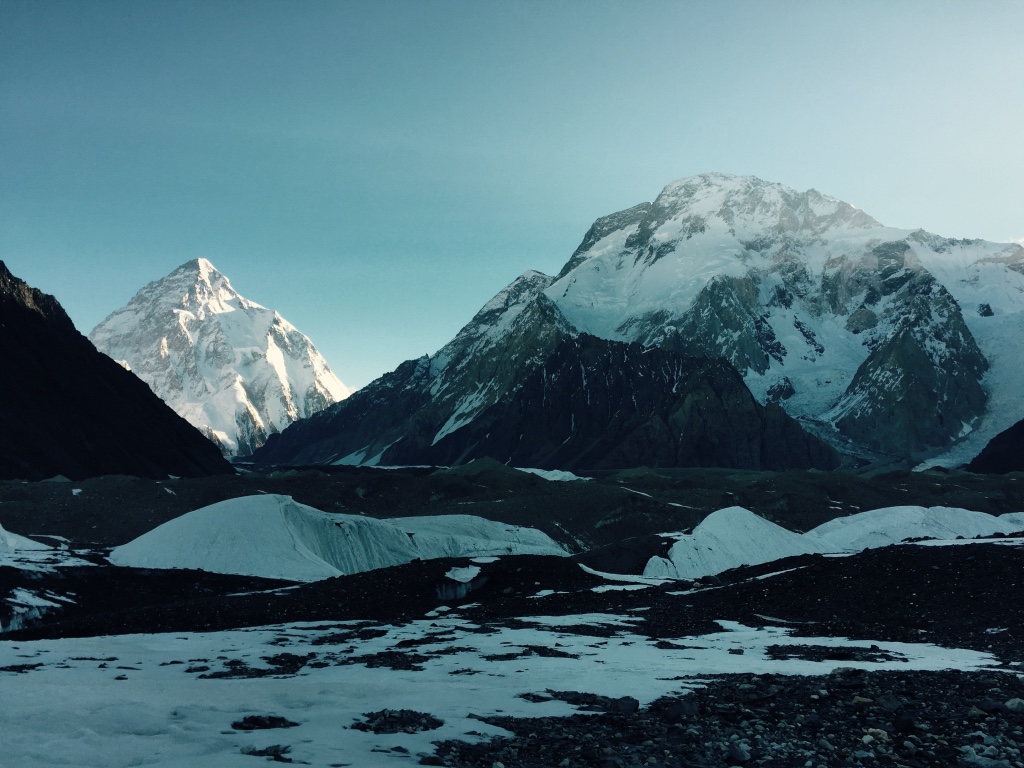
Trek to Goro 4,350m/ 14,271 feet. Now we are in the heart of Concordia with only ice on which to place our tents we are surrounded by views of the great peaks: Muztagh Tower, Gasherbrum 4 and the most spectacular of them all Masherbrum, it’s guaranteed to take your breath away. If we are rewarded with a clear evening, nothing will have prepared you for the evening sunset and the red hue over Masherbrum, it will never be forgotten! 7-9hours Day 12-13 Trek to K2 Base Camp 5050m the mountains had been placed in order for this trek, today the finale would have won an Oscar.
We move up to Concordia passing the Golden Throne and Mitre Peak as we enter the arena of the 8000m Peaks, first Broad Peak 8,047m/ 26,401 feet followed by the Gasherbrums and finally K2. The sheer size and scale of the 8000 meter peaks defies description, but this is a very special place and for many the view is a lifetime goal. Unlike many other treks to this area, ours continues up to K2 base camp where you will stay for a few days to enjoy the sheer majesty of K2 and its supremacy over this whole region. Distance: 12.2 km. Trekking Time: 7-8 hours. Elevation Gain/Loss: 329m/89m. Min/Max Elevation: 4,009m/4,279m
Day 10). Baltoro Glacier, Trek to Concordia 4,500m/ 14,764 feet
Baltoro glacier trek to Concordia offers the greatest spectacles of the Gondogoro La Trek. We continue our walk on the mighty Baltoro while participants pass by Mustagh Tower 7,284m/ 23,897 feet and Gasherbrum IV, partially obscuring behind it the Gasherbrum I 8,080m/ 26,509 feet thus called “Hidden Peak”. We can spot it on the right side of Gasherbrum IV with fin like ridges.
Making our route up on Baltoro, views of Broad Peak 8,051m/ 26,414 feet appear while Marble and Crystal Peaks appear on the left. K2 remains concealed till the minute we reach Concordia; a breathtaking sight that becomes a beautiful memory forever. Concordia is wide area of glacier which is one of the greatest places on earth. We will be surrounded by 4 eight-thousanders, 10 out of 30 highest peaks of the world. Camp will be set at 4,500m/ 14,764 feet in Concordia on the moraine. Trekking Distance: 11.8 km. Trekking Time: 4-5 hours. Elevation Gain/Loss: 289m/3m. Min/Max Elevation: 4,279m/4,570m.
Day 11). K2 Base camp 5,100m/ 16,732 feet and Broad Peak Base camp 4,800m/ 15,748 feet
On this day of Gondogoro La Trek, we can start early through crevasses and small rivers created by melting ice. We follow on the glacier that is named after Godwin Austin who first declared K2’s height. After three hours we will be at Broad Peak base camp where we will have a great sight of the astonishing Karakoram 2nd (K2), Mitre Peak behind us and the Bride Peak. We walk on the moraine which is mostly boulders. However, we do walk on ice occasionally.
After another 3 hours trek, we shall complete one-way journey of the K2 Base Camp reaching a moraine safe zone, a traditional base camp area for K2 climbers. One can also visit Gilkey Memorial if time allows. The memorial has names of brave souls inscribed on plates and plagues. These tough ones died attempting K2. The decisions about trekking to K2 Base Camp, Broad Peak BC, Gilkey Memorial, choosing one or another or all options or choosing to rest at Concordia on this day depends on the participants. Return to Concordia on this day is compulsory. Trekking Time (Return) K2 BC: 9-11 hours. Trekking Time (Return) Broad BC: 5-6 hours. Min/Max Elevation: 4,500m/5,100m.
Day 12). Trek Towards Ali Camp 4,800m/ 15,748 feet
We set out journey on a less explored route today. The nature and difficulty of trekking depends on snow which is not common between the months of June to late August. Normally we would walk on non-slippery ice which is in fact easy to hike on. In case of large crevasses, we would take short detours only to make progress. However in case of snow conditions at Baltoro, participants and porters would walk together (all hooked to a rope) and use their crampons for safety.After walking for more than 5 hours, we should reach the junction point of Baltoro with West Vigne Glacier that is linked to Gondogoro La’s base.
We set camp for tonight on the high moraine near the junction. Our campsite is known as “Ali Camp” as Ali (a porter belonging to nearby village) had first been recorded to cross Gondogoro La while returning as a porter from a climbing expedition to Gasherbrum. Reaching camp, we would have enough time to learn and practice some basic skills for moving on the Gondogoro La Trek’s fixed lines the following day. Trekking Distance: 12.1 km. Trekking Time: 5-6 hours. Elevation Gain/Loss: 376m/13m. Min/Max Elevation: 4,500m/4,800m.
Day 14). Gondogoro La pass
Gondogoro La Trek-Crossing the Gondogro La/Pass 5,585m/18,323 feet towards Khuspang On this day of Gondogoro La Trek, participants are woken up sooner than first light. After a good breakfast, harnesses and crampons are put on and we hit the incredible West Vigne Glacier, all roped as one unit until we make to Gondogoro La’s base. Depending on weather and snow conditions on the lower slope of the high pass, we may possibly continue as one unit attached to the rope or we might be in a position to ascend the slope un-roped.
Normally there would be at least one steep part to cross on the higher slopes. During these parts of the climb, our support crew will fix ropes. It normally takes around three hours to reach the top of Gondogoro La Pass. One can have a splendid view of four of the 8,000 meter peaks, specifically Gasherbrum 1 and 2, Broad Peak and the mighty K2. The giant pass is one broad shoulder from where we get a perfect view of the astonishing Gondogoro valley on the opposite side. While descending down the other sturdy side, one can enjoy views of Trinity peaks, not to mention the stunning Laila Peak 6,096m/ 19,111 feet.
The fall is comparatively sudden and therefore requires use of fixed ropes for most of the descend. Crampons would be required for the most part of moving down the pass and also on the upper segment of Hushey valley which will normally be covered in snow. Participants will need to watch their every step while descending to avoid jolting stones into their team members. Once the gradient eases, we get to a trail moving along the beautiful Gondogoro valley above Trinity Glacier that we meet soon. Gondogoro La Trek eventually becomes easy as we reach and move on the moraine and arrive at a valley with small pools and grass near the junction point of Gondogoro and Trinity glaciers. This pleasant campsite is called Khuispang 4,600m/ 15,091 feet. Trekking Distance: 8.1 km. Trekking Time: 9-12 hours. Elevation Gain/Loss: 798m/901m. Max Elevation (Pass): 5,585m.
Day 15). Walk to Dalsmpa Via Gondogoro Glacier
Today we pursue the Gondogoro glacier downwards and it will comparatively be an easy day on the Gondogoro La Trek. Normally we would pack our climbing equipment’s while descending towards Hushey valley and witness fresh landscapes. Participants trek on Gondogoro glacier’s moraine, walk below and cross Laila Peak. The official first summit on this stunning peak was made by Italian climbers in mid 1990’s only to find evidence of a previous mark on the summit by British mountaineers (Mark Miller, Simon Yates and Sean Smith) in 1987.
The Italians apparently did not know of a previous attempt by the British mountaineers before they found a used gas cartridge with inscriptions of four names. We continue and reach an edge of Gondogoro Glacier and find a trail into a beautiful valley of rhubarb and grass. We set camp at a gorgeous location known as Dalsampa 4,150m/ 13,615 feet. Trekking Distance: 6.1 km. Trekking Time: 4 hours. Elevation Gain/Loss: 102m/548m. Camp Elevation: 4,149m.
Day 16). Trek to Saicho
Trek to Saicho 3,350m/10,990 feet through Gondogoro Valley. We start off trekking through this amazing valley where participants camped last night. The valley soon comes to a sudden end where we are left with two options of trail. The first option is to trek down between cliffs and the glacier. The second option is to move forward on the cliffs. Our guide will make a decision based on discussion with local porters who trek more frequently and are aware of recent conditions on at least one of these routes. Gondogoro La Trek becomes easy once both these trails meet.
We continue trekking and pass through the pastures of Gondogoro. One can see temporary shelters made of stones by herders. Soon a little stream requires to be crossed before reaching the lateral moraine. One can observe big trees while walking on this moraine that goes down until the bottom of Gondogoro valley where camp is setup. Our campsite Saicho 3,350m/ 10,990 feet is a sandy part with thin grasses along the glacial river at junction point of the Charakusa and Gondogoro valleys. After almost one week above 4,000m altitude, “oxygen rich” supply of air will be available to breathe and participants can sleep better to the sound of running water. Trekking Distance: 11.9 km. Trekking Time: 5-6 hours. Elevation Loss: 798m. Camp Elevation: 3,350m.
Day 17). Contingency Day in Case of Possible Delays
There can always be a chance for delays at some point during Gondogoro La Trek. It’s always a good idea to keep time for this. Otherwise normally this day would be used for rest at Saicho which is a good camping site to get some sun bath, fill in your diary or do some laundry. Those who still want to explore can trek to Charakusa valley. If anyone opts for this option, we shall make an early morning start and pursue a trail upstream on moraine (lateral) of Charakusa Glacier, a habitat for snow leopard.
On a lucky day someone from the team may spot an animal or at least see signs of the big cat which our guides can guide you to. After crossing some ice and rubble, moraine and glacier, we make it to major Charakusa glacier. How far to go depends on when we start, glacier conditions and participant’s energy level. Although if every factor is favorable, we can walk far enough to get views of K7 and K6. It will approximately take 6-8 hours to make this round trip which is another great extra on the Gondogoro La Trek.
Day 18). Trek to Hushey’s Main Village, Last Trekking Day
Since we are below 3,500m/ 11,500feet, it is wise to start trekking early to stay away from heat that can go above 35 degree Celsius. This day will comparatively be an easy trekking day of between 3 to 4 hours. We will follow the river that brings the glacier melt of Charakusa, Gondogoro, Ailling and Masherbrum glaciers. The valley eventually turns south and gradually participants start to see signs of shelters, homes, fields etc and we finally ascend to a plateau where the central village is located.
The central village is made of alleys, traditional stone-made buildings built with river stones etc. The buildings are two-storey structures. Ground floors are used to shelter animals whereas the upper floors shelter humans.More recently villagers have also built modern houses. The village has a school, hotel, shop and a camping site for trekkers where our team will make camp. The remaining day can be used to rest or to explore the Hushey village and interact with the community who are tourist friendly and most hospitable. It will be the last day of camping on Gondogoro La Trek. Trekking Distance: 7.2 km. Trekking Time: 3-4 hours. Elevation Loss: 302m. Camping Elevation: 3,050m.
Day 19). Drive to Skardu Following the rivers of Hushey Shyok and the Grand Indus
The return road journey offers amazing sightseeing starting with passage through other villages of Hushey valley displaying small agricultural lands and mountain farming activities as we move downstream. We eventually come to the confluence where Shyok river (flowing from Ladakh) meets Hushey river. We will cross a bridge (suspension) above Shyok river to get to the other end. In the past traditional rafts (made of air-filled goat skins and large sticks) were used to pass the river. The goat skin was later replaced by tubes of tractor tyre in 1980s and this suspension bridge that is used now was built in1990s. After crossing of this bridge, we will find a surfaced road in Khaplu, a large village that has turned into a town.
Khaplu once was a princely state ruled by a Raja (Prince). Few signs of the princely state still exist. Our drive to Skardu from Khaplu becomes smoother and we gain pace on the paved road driving along the Shyok which leads us to the confluence with Indus River that we follow until we reach Skardu. We arrive at one of our partner hotels and get our first warm shower after more than two weeks, followed by a good meal.
Day 20). Fly to Islamabad, Sightseeing During the Afternoon
The drive from hotel to airport is 40 minutes and it’s a metal road. We board the plane for a thrilling flight towards Islamabad. We once again fly by the Nanga Parbat, saying goodbye to the mountains. On arrival in Islamabad airport our vehicle will take us straight to the hotel. We will settle in and have lunch if there isn’t any unusual delay. After a good meal participants can take the day for rest and sightseeing around the city. You can also do some last minute shopping for popular options like artifacts or rugs. In the evening we will be together to enjoy special meal at local restaurant or at our hotel and share experiences of Gondogoro La Trek.
Day 21). Contingency Day for Delays in Flight Schedule
Skardu is weather dependent area to fly as planes only operate when there is visibility for the pilot to land. The weather in summer is mostly good for the pilots to fly but mountain weather conditions may change to bring rain. Alternative way is to go by road through the Karakorum Highway which is a great experience for many foreigners. If we fly to Islamabad, the day can be used to rest and for sightseeing. The leaders of the trekking party will guide participants on this day with available options.
Day 22). Departure from Islamabad, Airport Transfer from Hotel
Finally, our land package for K2 Base Camp and Gondogoro La Trek ends only with breakfast and transfer to airport.
If you would like to sign up to one of our premium treks to K2 Base Camp then get in touch. CONTACT US and learn more about this exciting trekking adventure.
Training
Training for your K2 Base Camp Trek
Here is some training advice for your K2 Base Camp Trek. The first thing you need to do is consider the itinerary for you. We have two different itinerary. One trek is to K2 Base Camp and over the Gondorgoro La Pass at 5,600m/ 18,372 feet and completed a circuit. The regular K2 Base Camp Trek returns via the same way you came in.
Exploring the best training methods means a few things. You need to look at the elevation gain, daily distances, lack of oxygen and then plan accordingly. You can CALL IAN and get advice on how you should be preparing for this unique adventure in Pakistan. Ian has climbed Everest to the summit and led over 150+ treks and mountaineering trips around the world. Read this information and if you are interested in joining one of our trips feel free to EMAIL US today.
1). Physical Conditioning
Despite being a trek which is accessible to most people and not just experienced mountaineers, the trek to K2 Base Camp should not be underestimated as it is a long way from medical access and deep in the Karakoram mountains. This means excellent physical preparation is required. We require that only hikers and trekkers join our groups and this is not a tourist trip. Hiking in the Karakoram mountains is a serious challenge which requires significant preparation. With forward planning and the right attitude to training, however, you stand the best possible chance of successfully and safely reaching K2 Base Camp – and enjoying one of the most rewarding and spectacular experiences in the world. For anyone that is signing up to one of our trips we are happy to help give more specific training advice for this trek.
2). Training and Fitness
Trekking to K2 Base Camp is a physical challenge on walking in a low oxygen environment on a multi-day basis on rough terrain. The K2 Base Camp Trek is well within the reach of most people who enjoy a good standard of hiking fitness. However, training specifically for the trek is essential to prepare you for the particular pitfalls posed by mountain walking. You are strongly advised to seek medical advice before deciding to arrange your trek and before starting a training program, particularly if you have any concerns about your health. It is sensible to start training as early as possible before your scheduled trek.
Conventional exercise routines which build strength, fitness and endurance, such as aerobics and light weight-training can be beneficial, particularly if your fitness level is less than desirable. But the best physical preparation is activity which simulates, as far as possible, the demands on your body which will be happening during your ascent and descent to K2 Base Camp. Hiking up and down hills with weighted back pack is key to success doing this once a week building up to carrying 12kg/ 25lbs would be advisable along with daily stair master and incline treadmill sessions are also very important for a successful training program.
3). We can Help you Formulate a Training Plan
We can help in your preparation, so please ask as we have lot of experience preparing for this trek. You should therefore aim to make walking/ hiking/ stair climbing the main part of your training. Taking regular and increasingly long elevated hikes building the weight that you carry will help develop the muscles which will be needed when you arrive in the Karakoram mountains. Try to find some local hills to walk up and down if possible. Gradually increasing the duration of your walks will help to develop your stamina and also assist in preparing you for being on your feet over long distances.
When out on training walks, ensure that you always wear the boots you intend to take to the Karakoram mountains. Getting used to your footwear will help make you as comfortable as possible when it comes to your trek. It is also a good idea to wear the same back pack you will be taking with you on the climb so you feel at ease with it and gradually add weight to the bag to build strength over time.
Being mentally prepared will also be crucial to your chance of a successful trek. As this is a camping trip you need to be comfortable camping and have tested all your gear. Progressively pushing the limits of your physical training will help develop your capacity to endure the strain. A positive attitude is also crucial. It is helpful to remind yourself when training and during the trek that thousands of people have achieved this feat before you and that you can do it too. But do be prepared for setbacks and particularly difficult stages during the trek. And remember that your guide will be there to encourage and inspire you!
4). Making Your Training Successful
1. Give yourself enough time to prepare and pick the right acclimatization schedule. We have tried and tested our itinerary and acclimatization. In terms of training, it is no good trying to cram everything in a few weeks before you depart. It is proven that endurance is built up over months and years. Put your training plan together and build on your fitness over a longer period of time, this will also help you avoid injury. Check out our Top Tips for a safe and successful trek to K2 Base Camp.
2. Don’t ignore nutrition. You need a well-balanced diet to maintain a good level of health. As your routine picks up and you train harder, more strain will be placed on your carbohydrate stores. Before, during and after exercise you will need to supply your body with the fuel it needs!
3. Taper off the week before your trek. Reduce your training before you depart on your trek. You should have been training 7 – 12 hours per week. Get some well-earned rest and start your trip feeling fresh. Going on a trip knowing that you are fit and ready gives you one less thing to worry about, it boosts your confidence allowing you to get the most out of the experience.
5). Pacing is Critical to Success
We cover the daily distances as slowly as possible, our team should be the last group into camp. We don’t want to over exert the body, a relaxed, slow walk will aid your bodies adjustment to the lack of oxygen and keep your body and muscles from fatigue. This is so important on this multi-day trek to K2 Base Camp. Keeping well hydrated, drinking 4 to 5 liters of water each day is also critical to success. Once you sign up to one of our treks we will be available to you and help you train, prepare and have all the information you need. We also have a 20 page dossier, developed over 10 years of running our quality treks to K2.
If you walk in the hills and avid hill walker/hiker on a weekly basis, you should have the conditioning needed for the Trek. It is vital to be out walking in the hills in your trekking boots 3 – 6 months in advance on a weekly basis. You also need to add in some gym work if you do not have access to hills and mountains. We have training schedules for this and can talk you through this and make sure you are taking the right steps to succeeding at your chosen adventure. We recommend training 4 to 5 days per week.
Training for K2 Base Camp Trek is important. This is not a one size fits all program to training, as everyone starts from a different fitness base and building this type of conditioning will be different for different people. So CONTACT US and we can get you started and we will point you in the right direction. Just e-mail Ian Taylor ian@iantaylortrekking.com and find out more about starting your adventure to K2 Base Camp.
Training Information for Your K2 Base Camp Trek
Warmest time to Trek? June, July, August
Best months to Trek? May, June, July, August and September
Climbers are living in Base Camp? July / August
Clearest sky’s? (Not guaranteed)
Most snow? It can snow in any month
We hope you found this training information for your K2 Base Camp Trek useful. It is always easier to talk with us and we can help you fully prepare for your adventure.
Reviews
Price
From
$5,750
/ person
Information
Country:
Japan
Duration:
8 Days
Distance:
72km / 45 miles
Max. Altitude:
3,776m / 12,389 feet
Difficulty:
Challenging
Group Size:
8
Ready to go?
Does our Mount Fuji Trek information excite you to take the next step towards achieving the world’s 2nd highest mountain?. If so, get in touch today.
Similar Treks
Manaslu Trek
Overview One of the Best Treks in Nepal Trekking around Manaslu is a truly unique experience, giving you an opportunity to visit a relatively “untouched” region in Nepal...
View more
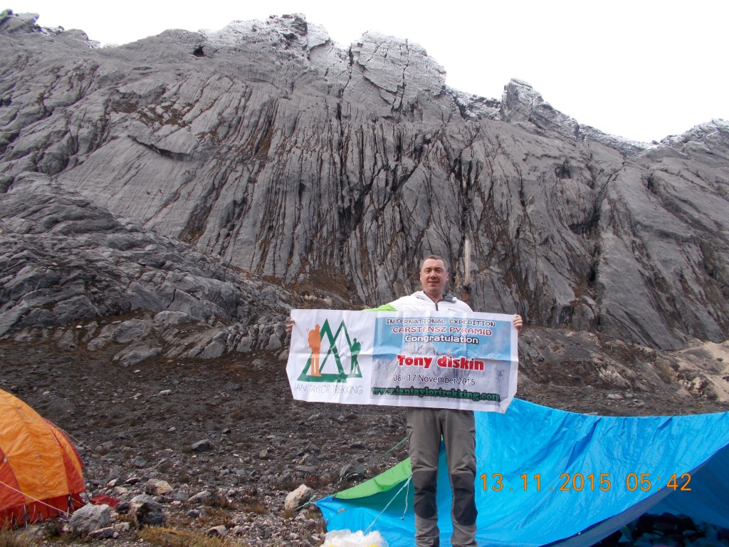
Carstensz Pyramid Climb
Overview Climb Carstensz on a NEW ROUTE and claim one of the coveted seven summits. Climbing Carstensz Pyramid has its climbing and regional challenges, but this adventure into...
View more
Kanchenjunga Trek
Overview Trek to the third highest mountain in the world Kanchenjunga is the third highest mountain in the world, known as the queen of the Great Himalayas stands...
View more
K2 Base Camp Treks
Overview Sleep at K2 Base Camp, it’s guaranteed to take your breath away. K2 is the world’s 2nd highest peak. The K2 Base Camp Trek is one of...
View more